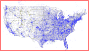
What is Tower Maps?
Tower Maps is a stand alone data (actually GIS formatted MS Access) package, updated quarterly and distributed to clients for their analysis, mapping and site acquisition activities.
|
Our HistoryTower Maps began data consolidation services in 1997 a time of tower infancy. Over the years we kept our focus on maintaining and delivering the most complete, most accurate and most up-to-date information on antenna sites in the US.
|
Copyright © 2024

